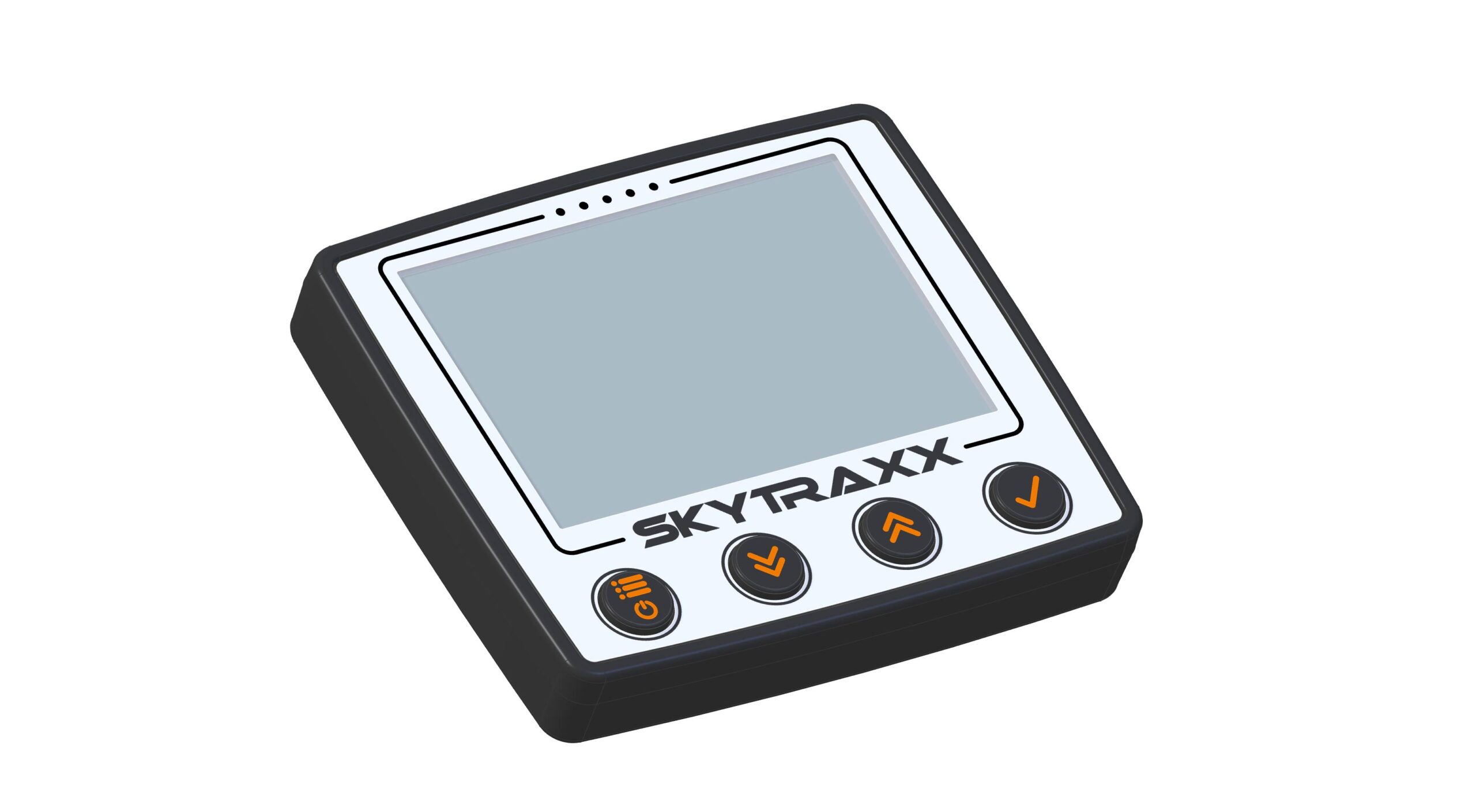

Skytraxx have released a new high-end flight instrument, the 3.0, whose colour display includes topology and terrain maps and airspace.
The unit has a high precision sensor and an integrated GPS/logger, and Skytraxx say it’s simple to use.
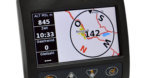
It’s a squarish, compact shape, (110mm x 120mm x 27mm) weighing 300g, and largely dominated by the hi-res colour screen which Skyrtraxx say is easily readable in sunlight. Underneath the screen are glove-friendly buttons.
Display
- height absolute height relative, amount cumulatively – switchable meters or feet
- Height above ground (AGL)
- Vario Digital
- XC score
- Barogram
- Glide
- Speed over ground
- Wind direction and speed
- Thermals display with track trace
- Distance to Start
- Flight
- Flight time, time
- GPS reception indicator
- Flight time, time
- Temperature in ° C or Fahrenheit
- QNH pressure indicator
- Flight Level
- Map (terrain, topology, waypoints, airspaces)
- Distance to waypoint, required glide ratio to waypoint
- Distance to the nearest airspace
- Smart Widget airspace
- Battery Meter
- Charge Indicator
Technical specifications
- ARM Cortex-A5 @ 500Mhz
- 8GB Memory
- USB Host + Client
- WiFi and Bluetooth via USB
- Global Navigation Satellite system
- G-Force sensor
- Pressure Sensor
- ACC sensor
- Gyro
- Light sensor
- Magnetic Compass
For Developers
- Open platform
- Linux source open
- SDK free
- Support for third-party
- LK800 / XCSoar / Tophat compatible
The 3.7V 6800 mAh lithium ion battery has a battery life of 20-22 hours, and RRP is €645 +VAT.
• Got news?
Send it to us at news@xccontent.local.
Subscribe to the world’s favourite hang gliding and paragliding magazine home