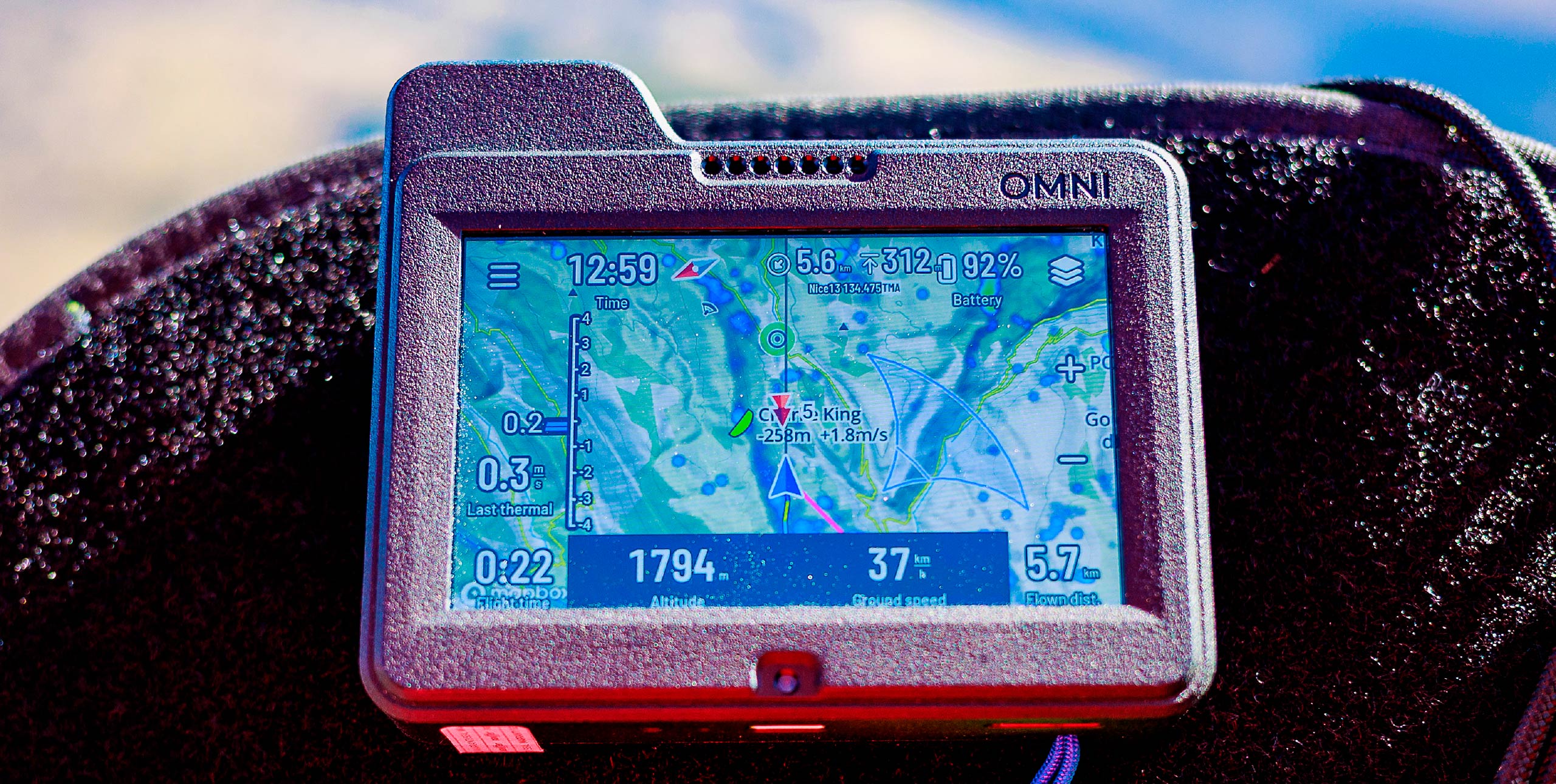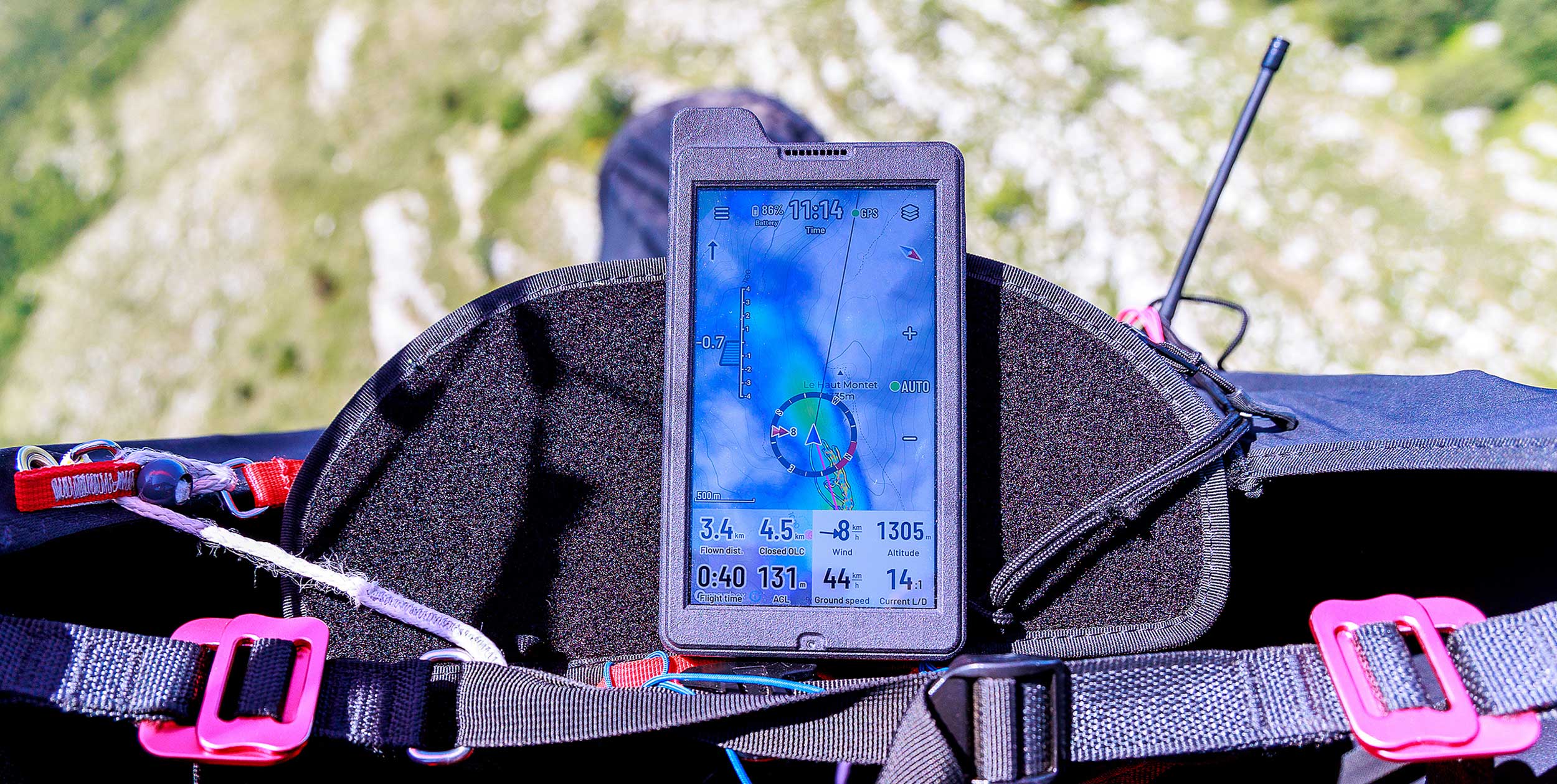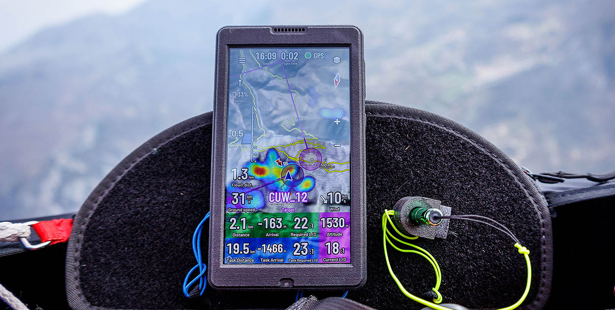
Joanna Di Grigoli has been long-term testing Naviter’s free-flight smartphone app.
Call me old school, but I’m the kind of pilot who flies with her phone in her pocket. I’ve always flown with dedicated flight instruments and for me, my phone was well… just a phone.
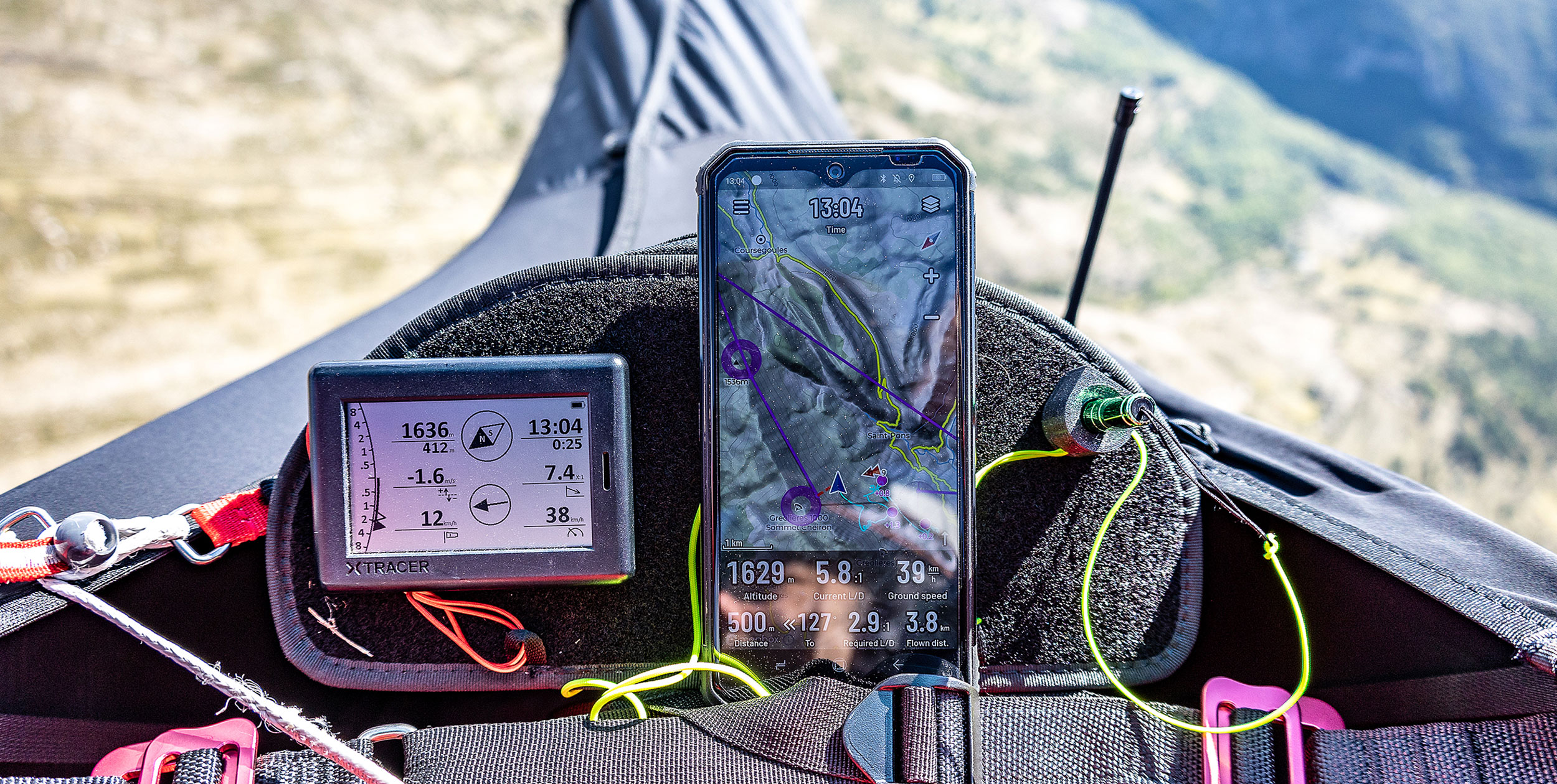
But when I put together a lightweight XC hike-and-fly kit, I started to look into the apps that were out there to use with my iPhone and, to be honest, I wasn’t convinced with what I found. I ended up just flying with the sound of my solar-powered vario, an XCTracer mini.
It all changed when I saw that Naviter were releasing an app, SeeYou Navigator. Since I’m a big fan of the brand and I’ve owned every single one of their instruments, I signed up for their beta testing program on the iPhone and gave it a go. What follows are my impressions made from using the app in both cross-country flying and hike-and-fly over several months.
Getting the app
The app is available for both Android phones and Apple iPhones – you just download it from either Google Play or the App Store. There is a basic version for free and a full version for €59 a year. Overall it scores 4.3/5 on the App Store and 4.2/5 on Google Play (with 5,000 downloads), which is a confidence-inspiring start.
As soon as you install the app it asks for your SeeYou Cloud user information, which allows you to use more features like waypoint collections, logbook and rain radar, among others. Of course, you can use it without having a SeeYou Cloud account but it is designed to be used as part of the whole Naviter ecosystem.
My first impression when I opened the app on my iPhone 12 Mini was it looked elegant and refined – very pro. When I then started to use it, everything felt intuitive and easy.
Factory settings
The main screen comes with basic information on it. Altitude, AGL, ground speed, a flight phase indicator, time, menu, and layers buttons are all shown over a map displaying airspace.
Setting up the screen to your liking is as simple as pressing and holding any of the items, which then display a dropdown menu with options like add, move and resize, edit, and remove.
The app offers a nice variety of options for Navboxes, indicators, and buttons. I was very happy to see a compass rose in the settings as it’s something I’ve been begging Naviter to add in the Oudie, their standalone flight instrument.
Among the Navboxes, you can find the classic ones such as position, navigation, and statistics info that will allow you to free fly at your local site, navigate to waypoints in your collection, and even go XC. You can change the colour and transparency of each item quite easily, while dragging them around and resizing them is once again simple and intuitive.
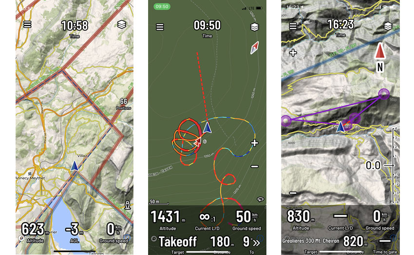
1 Factory settings showing base map and airspace
2 The thermal assistant automatically zooms in
3 A short triangle task displayed as a purple line
Getting started
When you click on the main menu button you have access to shortcuts to targets, gliders, devices, logbook, and even an exit button that sets the app to sleep mode to save battery.
One thing I found neat is you can set up as many gliders as you like, so if you’re going to use the app with different gliders you’ll save time when you upload your flights later to online contests. More on that later. Entering your glider data is easy: there is literally a library of all the paragliders that exist in the world, so you won’t be making spelling mistakes. You can even enter the glider’s size so you’ll be using the most accurate polar-curve information there is.
Pairing a Bluetooth device is a no-brainer. All you have to do is switch the device on, wait for it to show on the list and click on it. Magic! In my case, I paired the app with an XC Tracer Mini II and the pairing process was uneventful.
The logbook is very clear. It shows all your flights on a list with the tracklog displayed on a map. Click on a flight and it will show basic statistics and options to open the flight in SeeYou.Cloud, send your flight via email, WhatsApp or whatever, or even claim it on the online contest of your choice.
On top of the logbook page, there’s a summary of flight time, flights, and kilometres flown just to remind you that you need to fly more or work more.
You can add Navboxes and buttons from the settings menu, as well as change the screen orientation, units, enable/disable sounds or the thermal assistant, among other settings.
I didn’t get to try the integrations, but the app lets you link your SkySight and TopMeteo accounts to have weather info while you fly.
In flight
After customising the app to my needs it was time to see it working in the real world.
Once in the air, the app worked beautifully. It showed me moving around the terrain smoothly, without any delays, and the information that was being displayed made sense to me and what I was feeling and hearing from my vario.
The terrain map looks amazing on the iPhone, but after a while I decided to switch to the light map, which lets you see the screen better (and is not ‘light’ on battery).
Thermal assistant
The thermal assistant works really nicely. Like in the Oudie instrument it zooms in as you make your circles, showing your tracklog in different colours so you know where you’re climbing/sinking better or worse. I was surprised not to see the option to choose the thermal assistant to display bubbles (not that I like that mode), but when asked Naviter confirmed they were working on that (and an FAI triangle assistant) for a future update. Once you leave the thermal the app zooms back out to however your map looked before.
Zooming in
I really like that you can zoom in and out by pinching your fingers, just as you’d do with a photo. You can also add zoom-in/out buttons so you can easily zoom in the air using a stylus. You can change that in the settings to swipe mode, but then you’d need to move the map around using two fingers and I didn’t find that practical in flight.
Layers
The layers menu has a lot of neat features such as four base maps and layers like OGN, airports, paragliding sites, airspace, rain, Skyways, and thermals. Of course, Skyways and thermals info are based on every single tracklog ever posted online, so please don’t go straight to wherever is red without looking at the terrain and the conditions, but the information can come in handy, especially if you’re flying in an area you don’t know.
Airspace is displayed as you’d expect, in different colours with the relevant basic information.
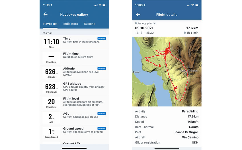
1 You can add these Navboxes to your home screen
2 Every flight is recorded in detail and can be automatically uploaded to your chosen online contest
Waypoints
Navigating towards a point is very easy. You can either press-and-hold a random place in the map and choose to go to it, or choose a waypoint in your collection and follow the red dotted line.
Beta version
As I said earlier, I signed up to their beta testing program which gave me access to features that will be available in the future. Anyone can try the beta version via TestFlight and contribute to the app’s development.
The latest beta version I tried lets you create tasks either from scratch using the waypoints in your list, loading a task you’ve already created in SeeYou Cloud or scanning a QR Code using the back camera.
Creating a task was very intuitive. All you have to do is choose a waypoint from the list or look for it in the search field. After you’ve added your waypoints, the app sets the second one as a start gate and the last one as ESS by default.
Naviter have also added more Navboxes like altitude gain in a thermal and thermal assistant zoom options, among other new features.
The verdict
This app is great for anyone who wants to fly with their phone, with or without an external vario. It’s perfect to have it installed and ready in case your main instrument bugs on take-off, or if you break the screen while towing in the middle of your 10-day expedition in Brazil.
Some things I’d like to see it do, though, are the map re-centring on its own after a few seconds so you don’t have to hit the re-centre button with your nose; choosing which camera to use to scan QR codes for easier task sharing; social media sharing options (we all like to brag about our flights once in a while); task sharing via messaging; clickable airspace to show detailed information; livetracking; and being able to create new waypoints in the app.
Knowing Naviter I’m certain they will be bringing the amazing features of the Oudie into this app and I’m really looking forward to seeing it evolve.
IN BRIEF
Naviter say: “Simple to use so you can focus on your flying”
Use: Thermalling, XC, hike-and-fly
How to use: On its own or pair the app with a simple vario and you have a fully functioning flight computer in your phone with excellent base maps
Pilot level: Beginner to advanced
Main features: Records your flight; thermal assistant; airspace; final glide; rain radar; integration with TopMeteo and SkySight; upload to online contests; SeeYou Cloud integration; logbook
Connectivity: Bluetooth
Cost: Basic app is free; the full app costs €59pa
Just for Cross Country readers, get 30% off your first year’s subscription to SeeYou Cloud by using coupon code XCMAG at naviter.com
Published in issue 226 (Dec 2021 / Jan 2022)


