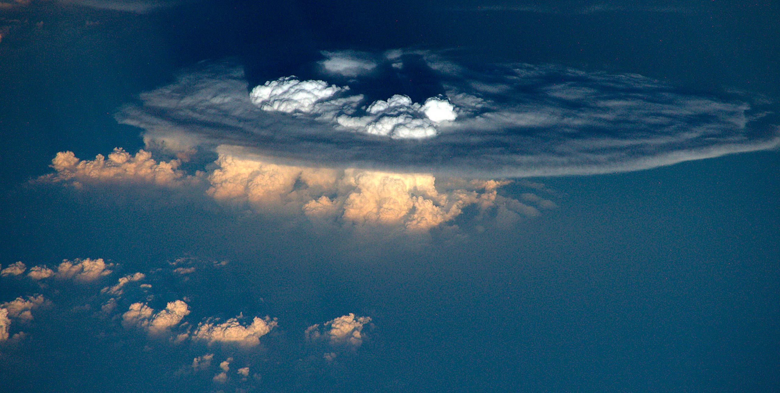
Embedded cumulonimbus clouds are storm clouds implanted within a stratus layer. Put simply, the sky is overcast, cloudbase is flat, and individual storms or a line of storms protrude above the overcast layer. This presents an obvious challenge for seeing storms from below.
In fair weather, thermalling under a large cumulus, the strongest lift is usually found under the darkest section where there is most vertical development overhead. Intuitively this should apply to embedded cu-nims as well. However, pilots must be careful in relying on this concept for identifying embedded storm clouds.
If the overcast stratus layer is thin, the sun is high, and there are no high cirrus clouds above, then dark sections could indeed indicate embedded storm clouds. Often however, the stratus layer can be thick and embedded cu-nims will form cirrus clouds as they reach the tropopause and spread horizontally. The cirrus cloud is the anvil or pancake at the top of the storm.
The shading of an already thick stratus layer can...