Marcus King tests the Skytraxx’s 2.1, a lightweight and simple yet fully-specced cross country GPS/vario.
The Skytraxx 2.1 is the latest instrument from Skytraxx. It sits in the middle of their range, below the colour-screened 3.0. It is a fully-functional GPS/vario with competition functions as well as built-in FLARM for improved security.
The unit
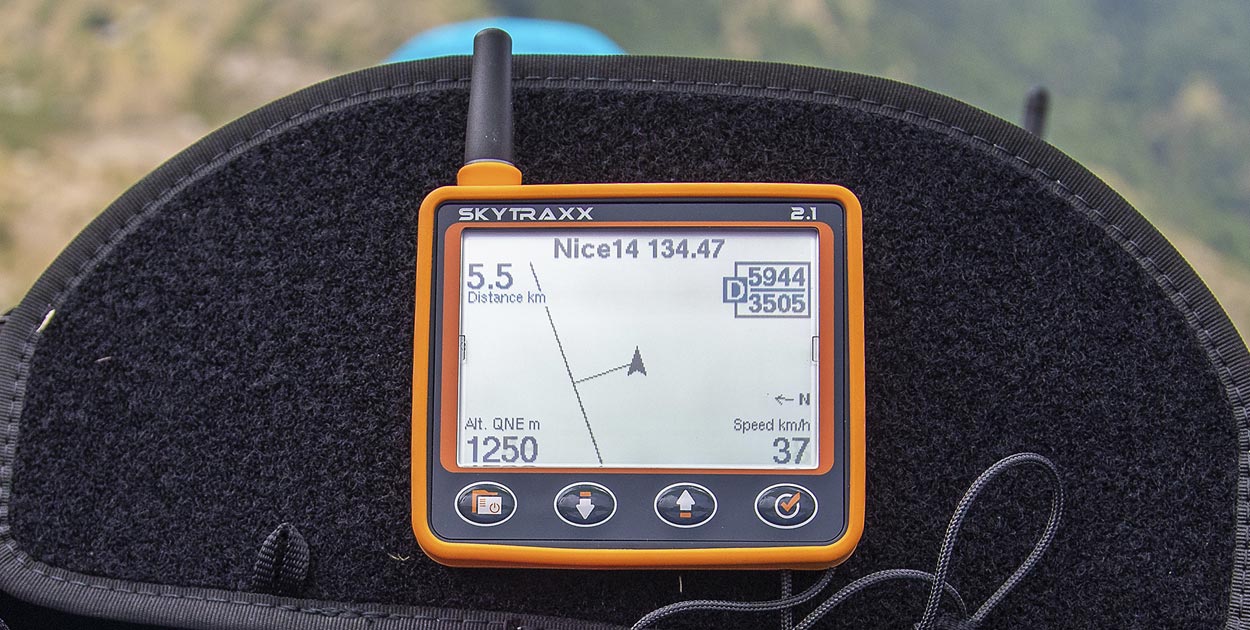
Finally, a case I won’t lose in the recesses of my bag – it’s bright orange! Open it up and you find an instrument that is a similar size to the Naviter Hyper. The difference is it is landscape orientation, and it’s a little shorter. One immediate note is there is no obvious way to mount it on your risers, which is a shame.
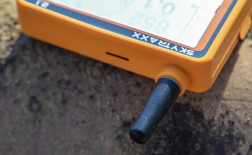
An aerial for the FLARM system sticks out of the top. The black-and-white LCD screen takes up most of the front, with four buttons below. A protective orange rubber bumper runs around the sides, to keep it safe from the rough and tumble of flying.
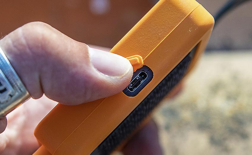
On one side, under a rubber flap, is the USB-C port. It’s nice to see this new format being used, as they are much less fiddly and bang up to date. The port is used for charging the instrument as well as connecting it to a computer. On that, the instrument acts as a mass storage device, which makes it a breeze to copy files to and from.
Simplicity by design
It has obviously been designed to be as simple as possible to use, while at the same time retaining all the functionality you need. I found it easy to use without the need to resort to the manual.
Updating the instrument is simple – just connect it to your Wi-Fi at home. This not only offers firmware updates, but will also update the airspace and obstacles database (via XContest), making it simple to keep flying with the latest data. If you get into the habit of switching on in range of your home Wi-Fi, then you can be sure the data will always be up to date.
On first power-up there is a series of pre-set screens that you can choose to have enabled or not, as well as in which order you would like them. Each screen has a certain number of fields that are user-selectable. The screens don’t automatically switch between themselves depending on what you are doing in flight, as they do on some instruments, but this does mean things stay simple. The design of the buttons also makes switching easy with gloves on.
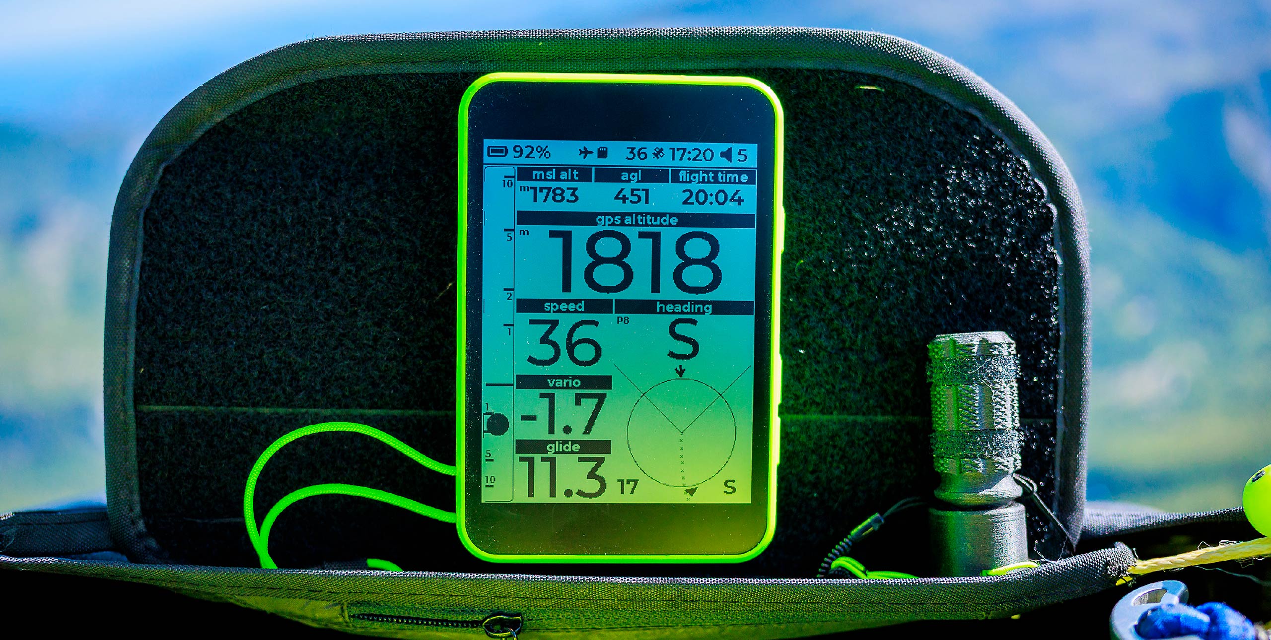
What the screens show
The main screen shows pretty much all the information you need. There is a vario scale on one side, with instant and average climb rate. On the right is a compass rose showing your heading, wind information and next turnpoint, if you are flying a task.
Altitude, speed, height above the ground, glide ratio and flight time are all shown as data fields, the last three of which can be changed by the user.
The next screen is the thermal assistant. This gives you a representation of the lift you have flown through, with the system accounting for wind drift. The track gets thicker in lift. When the machine has calculated the position of the thermal it draws a circle, and also your predicted track, so it’s easy to use.
What’s the vario like?
Talking of thermalling, the sound of the unit is a great mix of sensitivity combined with a relaxed vibe. I felt right at home straightaway.
There are a series of built-in profiles that you can choose from, or you can create your own via the Skytraxx website. You can also set a negative-lift threshold to get a “thermal buzzer”.
For example, if you set the threshold at about -0.6m/s, you will know you are in rising air (your sink rate is, say, -1.0m/s) and that there could be better lift nearby.
Keeping the pilot airspace-aware
Things are again kept simple on the screens. The map screen shows airspace, any active task and nearby paragliding launches and landings plus any obstacles.
There is no attempt to display any terrain, keeping the display clean and easy to read. If you do want terrain you will have to run a tablet alongside the Skytraxx, which can then send GPS and barometer data to it.
A more dedicated airspace screen gives you more information about the nearest airspace, and shows a line indicating where it is from your current position. You can step between more distant airspaces using arrow keys.
Another screen shows a cross-section of your predicted flight with a side view of the terrain and any airspace, so you can see if you will pass above or under it.
The system will alert you to any airspace you are close to infringing. It does that with a spoken warning and a pop-up screen showing distance and height to the airspace. It also tells you which way you should turn to avoid it.
Other screens include a triangle assistant and an XXL screen with three selectable fields and a large font. One other useful function, especially when you are getting to know the instrument, is the flight playback from the flight logbook. This is sorted by year and month.
Competition tasks
It’s easy to create a task from uploaded waypoints. A nice touch is that you can create a specific folder for a single competition’s waypoints. When you go to set a task it will only show you the turnpoints for that competition.
Creating XC routes can be done in the machine from existing waypoints or using software such as XCPlanner or Skytraxx’s own control software (only for Windows). I found the GPX format easiest to use, as this contains route and waypoint information.
On task the initial screen’s compass gives you directions to the optimum points on the waypoint screen. There is also a task-navigation screen – handily you can step through the turnpoints manually, but you can’t zoom in on the task. Nor is there any automatic zoom-in as you get close to the cylinder, which would be nice for a future release of the firmware.
FLARM and FANET
One of the most important functions built-in is FLARM. You can buy a version without this, but the saving is so little I can’t see why you would choose not to have it. The FLARM system means that you will be visible to other aircraft: useful when you are flying in areas with lots of sailplanes. They get a warning if they are on a collision course with you.
FANET, meanwhile, is a network created between devices, and also to ground stations. This allows the instrument to display the position and status of other pilots near you, as long as they are using a FANET-enabled device. If you set somebody up as a buddy you can see useful information such as height, climb-rate and distance from you. You can even send messages to them, including a pre-set SOS message.
You can also connect to LiveTrack24’s system for live tracking in areas covered by the Open Glider Network. The OGN can also pass your data onto other tracking systems. This does rely on there being ground stations where you are flying, but while testing in Laragne, France, an area with lots of gliders and hence ground stations, the instrument created a track correctly on Livetrack. Sections where I was obviously out of range of the Open Glider Network were missing. This service is all completely free, and once set up you just switch on and go.
Hike-and-fly mode
Hike mode records your hike as a GPX file. You can also upload a GPX route file, which will be displayed on the map while you are hiking. I created a track for a walking route using outdooractive.com’s planner and uploaded it to the unit easily.
With no terrain information it is very basic, but it can help you decide if you are on the right path. Going into Hike mode after you have landed will also tell the FANET system that you are on the ground, which can be useful for retrieve.
Conclusion
For those who like to keep things lightweight and simple this is a great unit and will do everything you need. A big bonus is it comes with the added security of the FLARM system.
Well thought-out software combined with robust hardware and good battery life makes it perfect for your flying adventures. In short, I’ve really enjoyed using the Skytraxx 2.1 day to day.
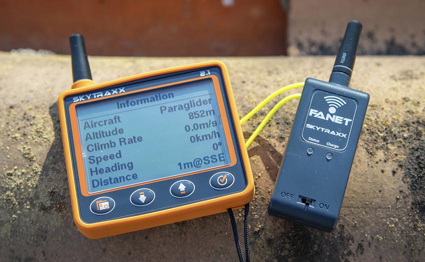
SKYTRAXX BEACON
During our test we used a Skytraxx Beacon to test the FLARM/FANET+ functions. This is a tiny, matchbox-size, standalone unit that transmits your position to other FLARM/FANET+ users. This is great if you just want to make yourself visible to other air traffic using FLARM. It will also allow you to make use of FANET+ for live tracking, where there are ground stations. The unit can also work as a logger and saves your flights as IGC files. The USB also allows the unit to be used as a GPS input or FANET+ modem as well as for connecting to a computer.
In Brief
Skytraxx say: “An easy-to-use hi-tec vario with high-precision sensor.”
Display screens: 9
Display: 240 x 160 grayscale
Size: 90 x 114 x 20mm
Weight: 150g
Features: Vario, airspace, FLARM/FANET+, Wi-Fi, auto updating
Battery: Internal, >40 hours
Warranty: Three years
Skytraxx 2.1 with FLARM: €549
Published in issue 203, September 2019