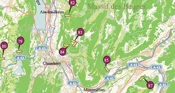
A Topo site guide to flying sites in the north-west of France has recently been released. It completes the four-book collection that cover the whole of France, giving detailed information on more than 600 sites.
The Topos detail access to the sites, their location and orientation, official landing fields, the level of pilot they are suitable for, top-to-bottom height and GPS co-ordinates. They also give useful safety advice, and information about site restrictions, typical cross-country routes, and suitable footpaths for hike-and-fly.

Click here for an extract from the first guide
The series of four books cover:
North-east: Northern alps to the Vosges
South-east: Southern alps to the Côte d’Azur
South-west: Pyrenees to Massif Central
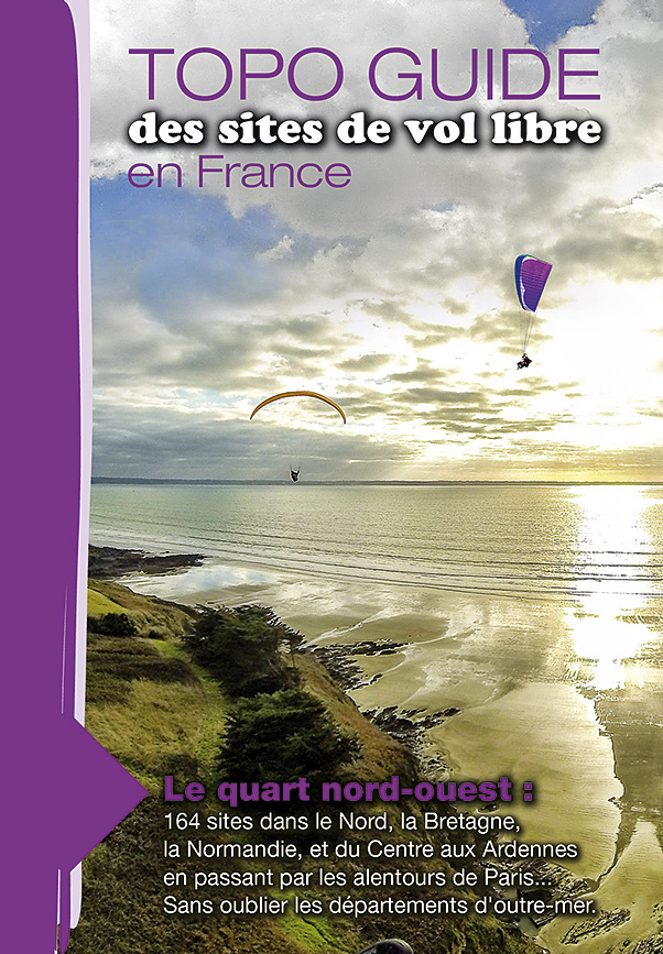
North-west: Brittany and Normany to the Ardennes, plus overseas departments
The North-west guide covers 160 take-offs, including coastal soaring sites on the Brittany coastline, those famous small sites around Paris with record potential, or if tropical forests, blue lagoons, tortoises and rays are more your thing, this volume also covers France’s overseas departments, including La Réunion and Guadeloupe.
The books can be ordered through the post at €29 each + P&P, using the form that is downloadable here.
Cross Country is a reader-supported international publication and is available through subscription only. We publish 10 issues a year in print and digital. Subscribe to Cross Country.