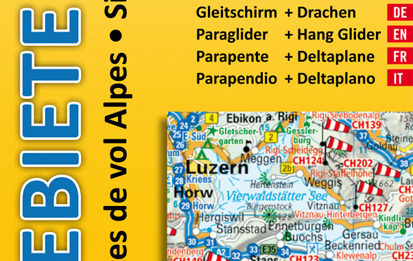
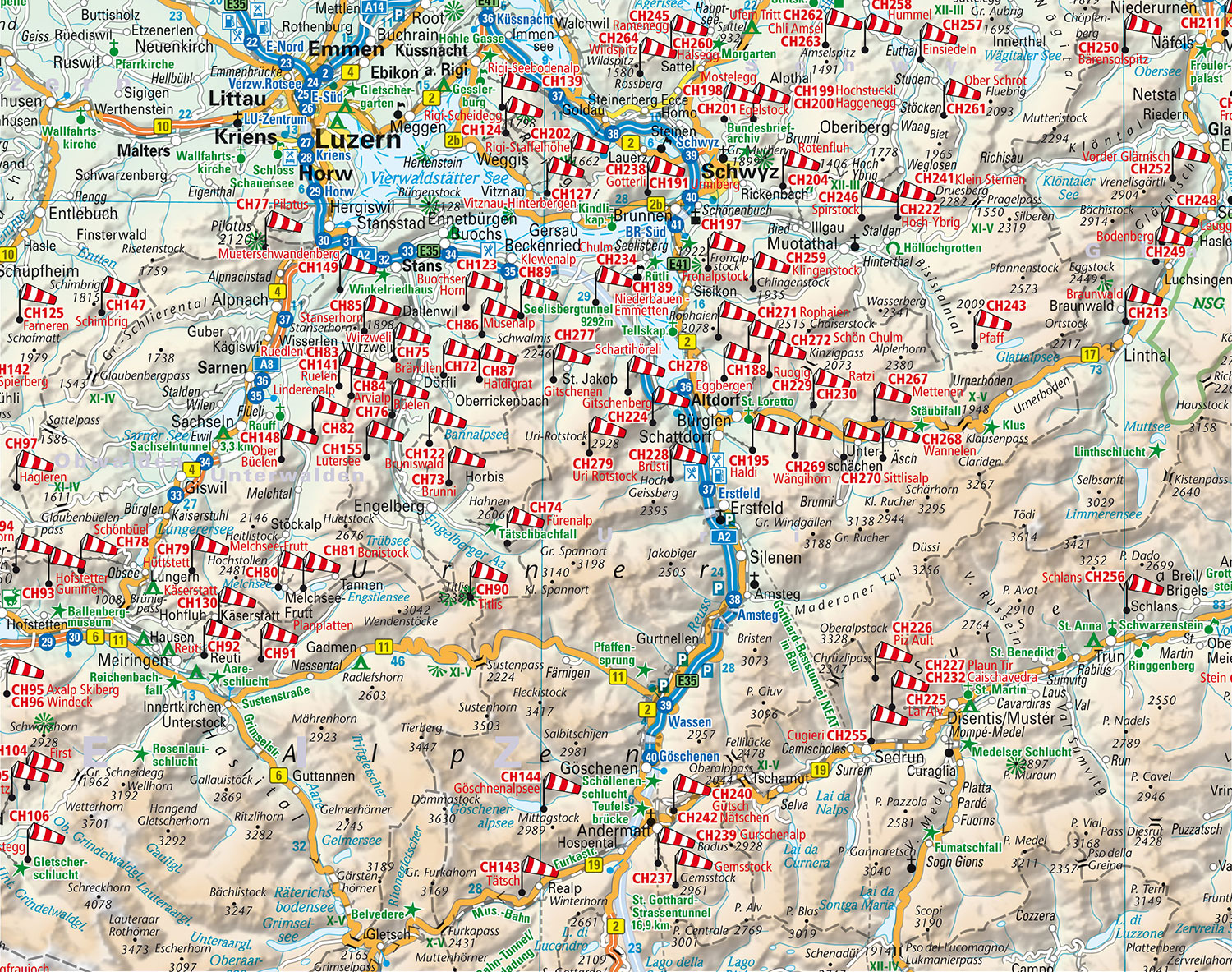
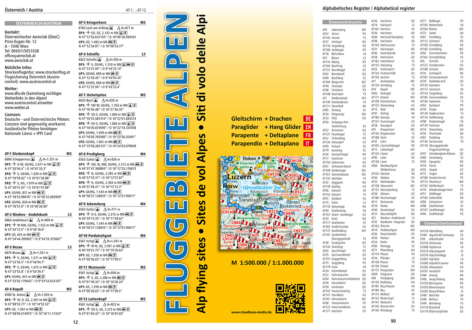
Cloudbase have published a map of more than 1,000 flying sites across the Alps, especially for paraglider and hang glider pilots.
It comes with a 96-page booklet detailing over 2,700 launch and landing sites in Germany, Austria, Switzerland, Lichtenstein, Italy, France and Slovenia.
East and West maps are 1:500.000 scale, and the Southern Alps 1:1.000.000. The map has text in English, German, French and Italian.
You can buy a copy at the DHV-Shop or on Cloudbase Media’s website, for €17.80 plus P&P.
• Got news? Send it to us at news@xccontent.local Buy and sell gear on Skyads.aero Home