Guide to Marshall, USA
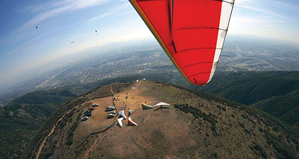
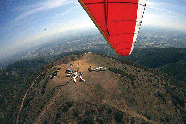
10 February, 2014- A spacious launch high in the San Bernadino mountains
- As consistent as the LA traffic jams
- March to August is the flying season
- On the border between the Mojave desert and built-up Southern California
WHY GO?
One of the most reliable mountain thermalling sites in the United States.
WHERE IS IT?
WHAT’S IT LIKE?
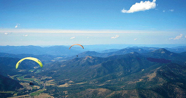
Welcome to California. Marshall Peak is not too far from the beaches and movie studios of Los Angeles, on the border between the Mojave desert and the southern California conurbation of 20 million people
Sunny “SoCal” means you’re going to fly – Marshall is as consistent as the LA traffic jams. The problem is not what to do on non-flyable days, it’s how to fit flying around everything else.
In 1979 Andy Jackson bought a landing zone for the site. Fifteen years, $500,000 and a relocation later, the Andy Jackson Airpark was born, providing the perfect landing zone wedged between seemingly endless gated communities. A defined landing pattern keeps hang gliders and paragliders separate on busy days: land on the West Spot for paragliders and the East Spot for hang gliders. The Andy Jackson Airpark is the only location in the valley where it’s legal for pilots to land. The City of San Bernardino has an ordinance against flying or landing within city limits, and the police can issue tickets to violators.
The strong thermal conditions mean the site is rated for intermediate/advanced pilots, but beginners can fly with slight restrictions. Pilots will find thermals along all the spines around Marshall, and in moderate winds the top is soarable. Look out for a whirling dust devil near the parking lot to know when it’s getting too strong.
[vimeo id=”70293637″ w=”602″]
Crestline is the upper launch. It sits on the ridge behind Marshall at about 1,000m above the landing zone. Its flat grassy launch is ideal for hang gliders. It’s often windier than Marshall, but on days with good lapse rates and light winds it can be great for paragliding too. The drive to Crestline is on all paved roads, and shuttles are available for both sites.
FLYING CONDITIONS
Before midday it’s hard to stay up, but within half an hour things suddenly pick up and the strongest part of the day is from then until three hours before sunset. After that things get sweet, with smoother air but still plenty of altitude. Autumn and winter provide milder conditions, but it’s still sunny.
WHEN TO GO
March to August, but the weather’s still good in winter.
ALTITUDE
Launch: 1,205/1,590m
Landing:518m
Cloudbase: 2,000m
HANG GLIDER ACCESS
Marshall is very hang glider friendly. Crestline launch is generally for hang gliders.
MUST BE FLOWN
The classic Marshall route is a great 60km out-and-return flight south-east of launch to the Seven Oaks Dam. Leave Marshall Peak at or above 2,000m, cross the Waterman Canyon and grab some height at Arrowhead Peak. Work your way to Mt McKinley then Mt Harrison. If you’re over the top of Harrison it’s an easy glide to the dam with a big LZ and road in front of it. If you don’t land, head back.
DANGERS AND ANNOYANCES
Southern California is infamous for the Santa Anna winds. Strong and gusty, they blow over the back of the site, usually setting up in the autumn, winter and spring.
There’s some Class D airspace nearby, so check the charts. On a good day it’ll be busy, so check the other air traffic.
Summer midday gets strong and dust devils sometimes blow through the LZ.
ACCOMMODATION
You can camp at the LZ for a $5 parking fee, but as of recently, there was a portable toilet but no showers.
About 10km from the LZ is a pilot-owned three-bedroom guesthouse.
GUIDES AND COURSES
www.flytandem.com
TAKE THE FAMILY
This is Southern California, what isn’t there to do? From surfing to Disneyland.
WEATHER INFO
It’s almost always good – just don’t go flying if strong winds are predicted.
www.crestlinesoaring.org
www.flytandem.com
GETTING THERE
Fly to Los Angeles. From the airport the only sensible way is with a car.
USEFUL CONTACTS
www.expandingknowledge.com
www.crestlinesoaring.org
• Got news? Send it to us at news@xccontent.local
Buy and sell gear on Skyads.aero


