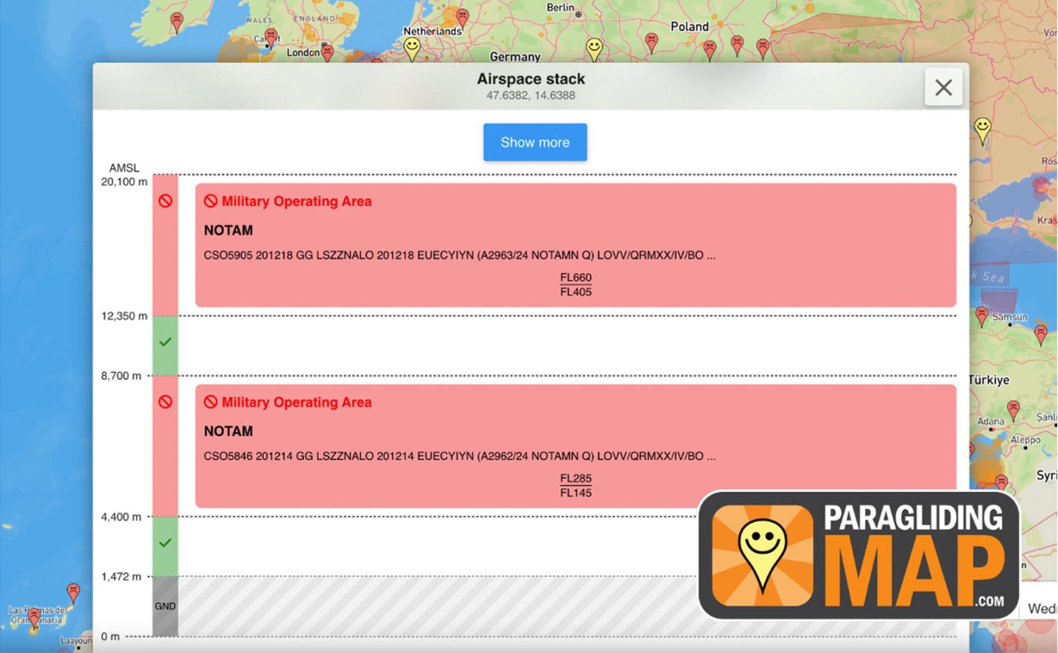
Notams – we all know we’re supposed to check them before flying, but how many do? Now Paragliding Map has made it much easier to check the latest airspace restrictions by introducing automatic Notam warnings.
Official aviation authorities supply the real-time Notam data and a prominent warning is shown whenever an active Notam impacts a launch or landing site. They are displayed with a three-colour system:
Red – No flying: The area is off-limits
Orange – Caution: Special conditions apply
Green – Open for paragliding
“Pilots rely on current and correct Notam data, and we’ve made it our mission to provide it,” says Craig Payne, founder of Paragliding Map. “Notams help paraglider pilots fly safely, legally, and without unpleasant surprises.”
The new Notam feature is available now on the Paragliding Map website and app.