Paragliding Map has come a long way since its beginnings in 2009, and 2021 saw many new additions including the game-changing addition of 3D maps.
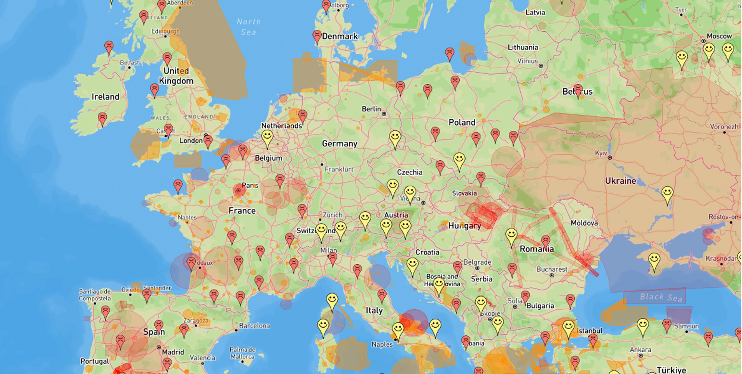
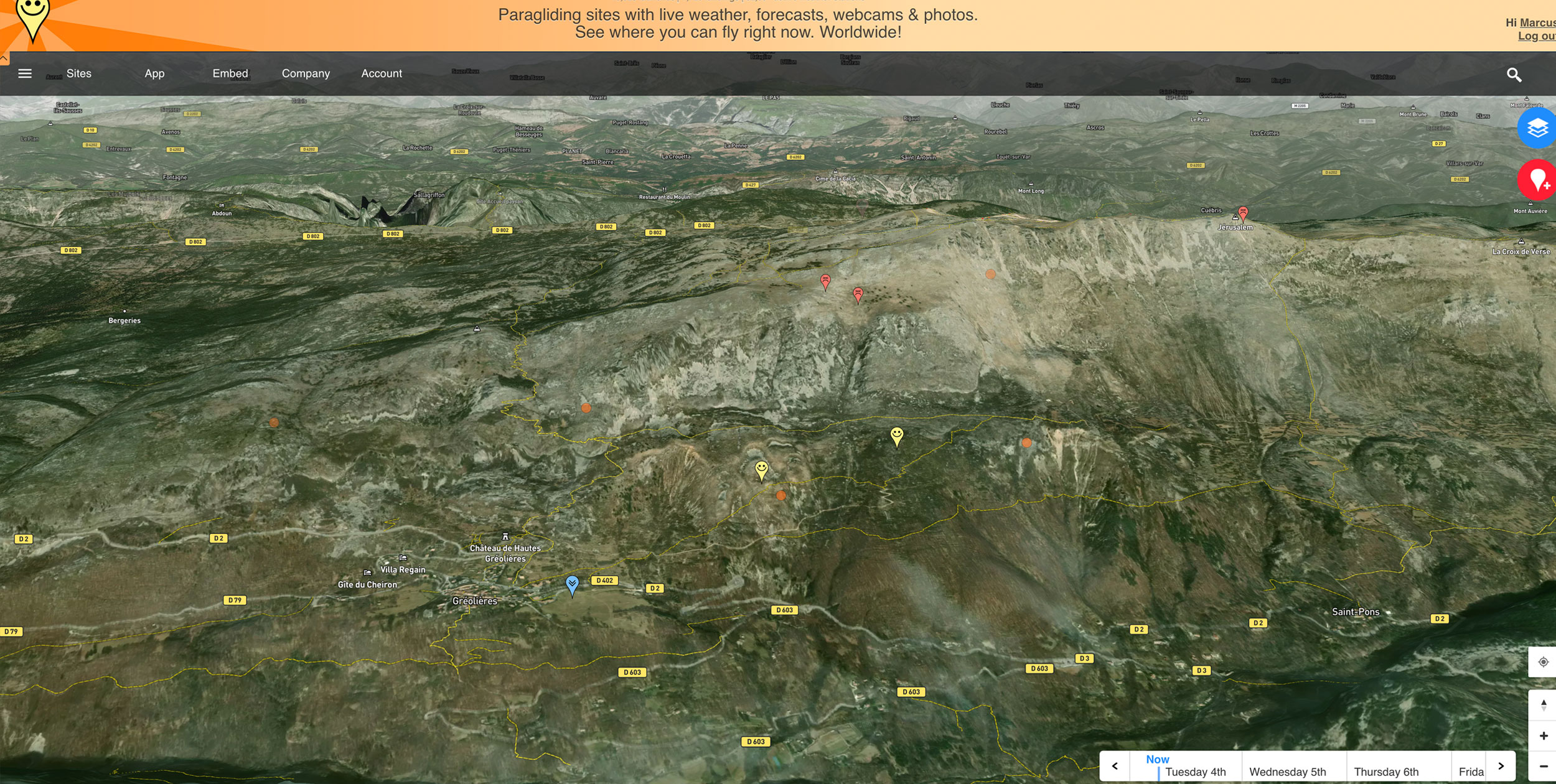
You can move around the maps and see whether or not it’s currently flyable, or due to be in the coming days, at a glance. Launches, landings, thermal hotspots and weather stations can all be displayed, with real-time weather reports from nearby weather stations, as well as forecasts. A Time Bar (visible in the main picture, above) allows you to choose ‘now,’ or look ahead to the coming days.
Below is a summary of the features that were added in 2021:
- 3D map
- Time Travel’ control for easy viewing of future conditions
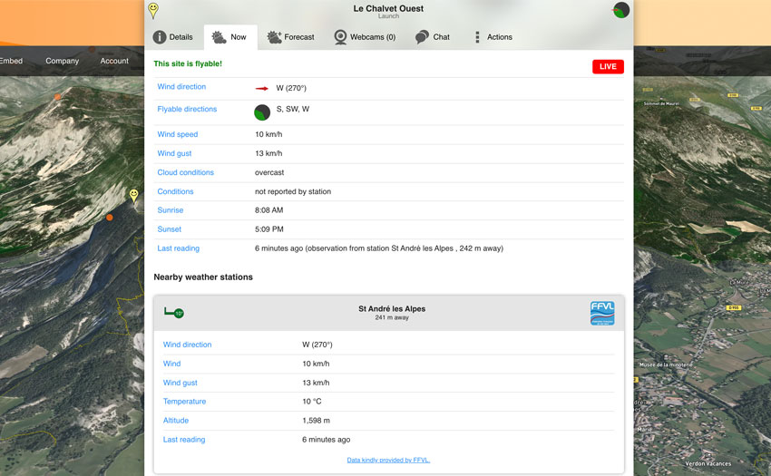
- ‘Now’ tab (picture below) displays whether forecast or live weather station is used (X-Alps competitor request)
- Nearby weather stations are now displayed in ‘Now’ tab for easy reference
- Extra wind speed units added: Bft, m/s, kt (user request)
- Meteoblue ‘Stüve’ and ‘Tephigram’ diagrams are now hourly instead of daily
- ‘My location’ now available on the free map layer
- ‘Forgot password’ feature is now much easier to use
- Refined the user interface
- Improved performance
It’s still free to use to see live information on 2D maps, with the 3D maps, hike-and-fly trails, live webcams, ski-lift info, auto-translator among the features reserved for subscribers. A subscription costs €3.99/month if you pay annually, €4.99 if you pay monthly, with a one-month free trial period.