The practice task at the Paragliding World Championships in Colombia has already thrown up an interesting point of contention: flying in fire thermals.
As we report on the Airtribune blog:
The land around the site here is agricultural, with a lot of space given over to sugarcane. When the farmers burn off the stubble they use a mix of gasoline (petrol) and diesel to set the fire. The result is a field of burning stubble, with a big plume of smoke.
Pilots can use the rising air to climb, just as they would a natural thermal, but they can also be dangerous. In a competition here a couple of years ago pilots tried flying in fire thermals but were met by 18m/s climbs and very turbulent air.
Organisers decided this was too much of a risk for competition flying (free flying – fine, as you like) and so banned flying in ‘fire thermals’.
So when is a fire thermal a fire thermal? You may well ask how long is a piece of string. The Swiss Team have already been lobbying to allow flying in fire thermals, saying ‘up to 7m/s should be fine’.
Organisers counter that is too close a margin, that 7m/s may rapidly become 14m/s, and they don’t want pilots coming down under reserve into a burning field of petrol-powered sugarcane.
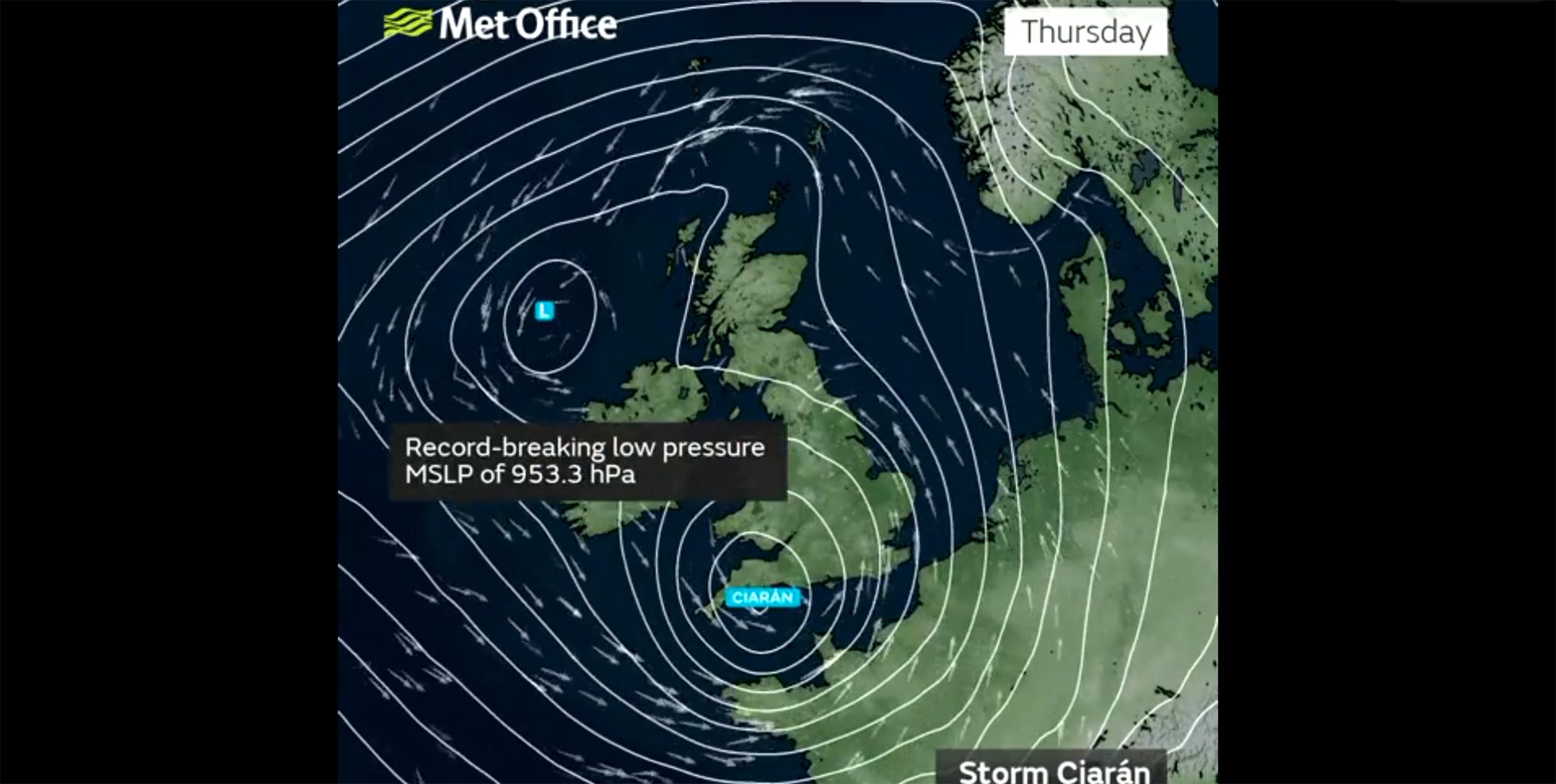
We published a photo story on fire thermals and, to give them their official name, pyrocumulus and pyroCb, in a recent issue of Cross Country magazine. Pyrocumulus are real and have only been studied for a few years. These photos are all courtesy of Nasa.
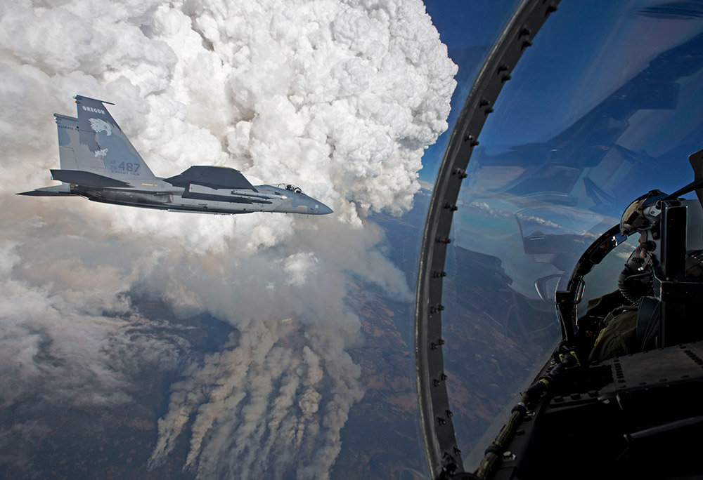
A fighter jet flying near a pyrocumulus cloud. Photo: James Haseltine / Oregon Air National Guard
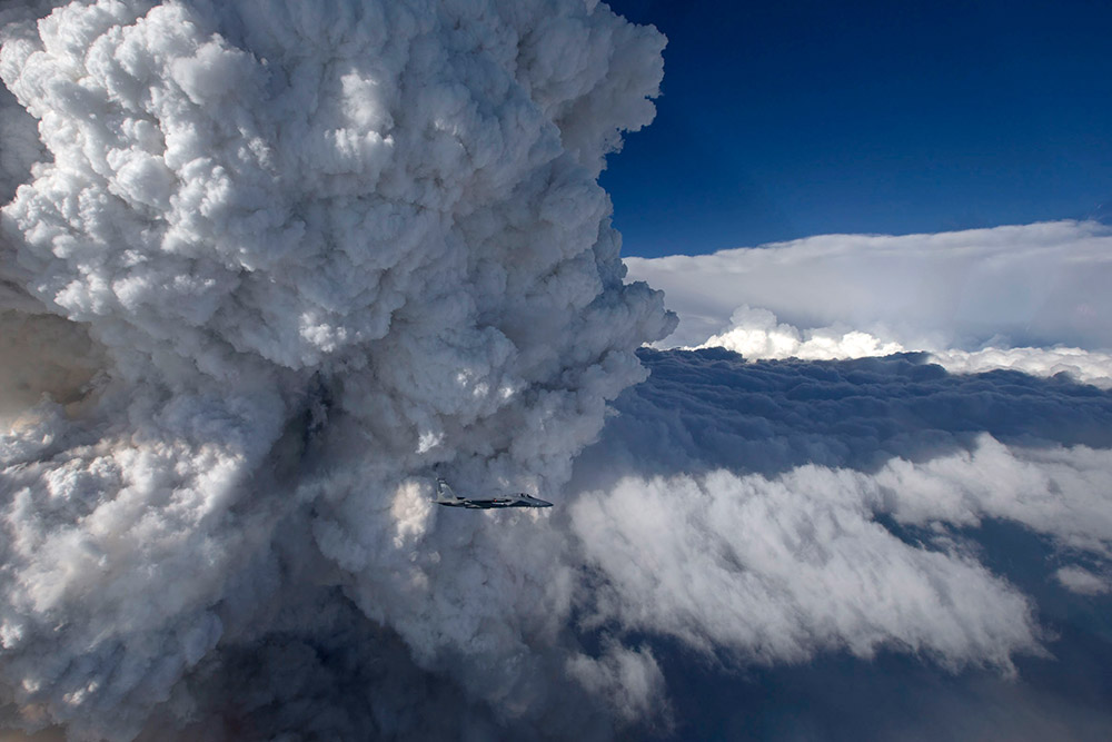
Photo: James Haseltine / Oregon Air National Guard
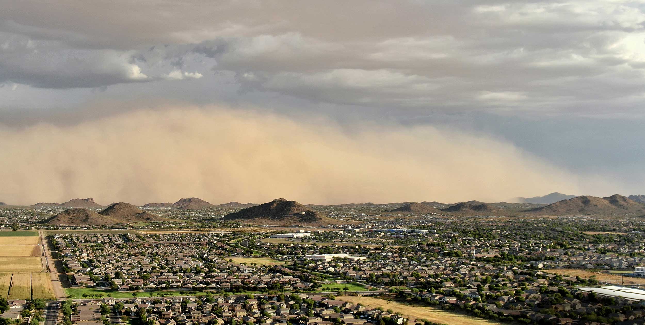
These two spectacular photographs were taken from an F15-C on 31 July 2014 at 8.20pm local time. It shows a wild fire close to the Oregon/California border and is a rare close-up of a pyrocumulus cloud (pyroCu). These clouds form in the same way as normal cumulus clouds, but the heat source is a fire down below, not the ground radiating heat from the sun.
Just like cumulus clouds, if the air is unstable enough then they can turn into storm clouds – pyrocumulonimbus (pyroCb). And just like regular cu-nims that can mean winds, gust fronts, lightning (and more fires) and even rain and hail (dampens the fire). Scientists and firefighters have only recently started to investigate these relatively rare beasts.
Firefighters usually monitor fires from below, but if a pyroCb develops then they need to monitor what the wind is doing aloft too. Scientists meanwhile are starting to recognise that pyroCbs can be responsible for injecting “hemisphere scale” amounts of pollutants into the upper atmosphere. Pollution previously attributed to some volcanic eruptions, including Mount Pinatubo in 1991, is now thought to have originated from unrelated pyroCbs.
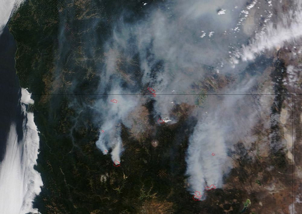
Photo 1. Photo: NASA
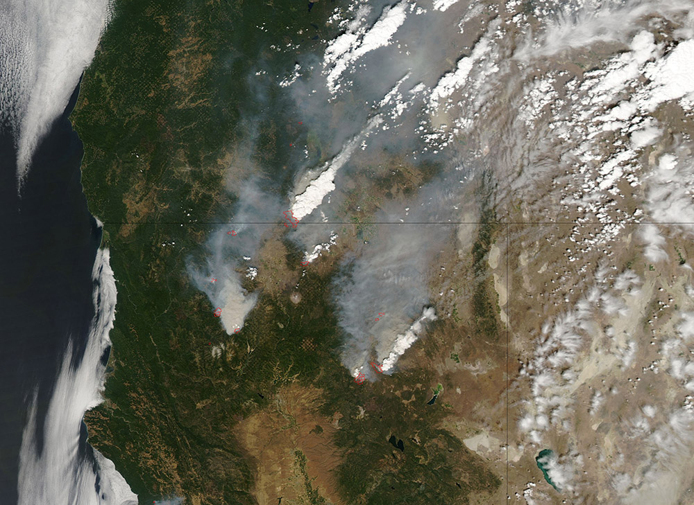
Photo 2. Photo: NASA
In this series of two photographs taken a couple of hours apart a few days later, on 3 August 2014, you can see the development of these pyrocumulus clouds. In the first photo you can see the smoke being dispersed by the wind, affecting air quality over a wide area. In the second photo you can see how large areas of pyrocumulus clouds have built up. Flying near pyrocumulus clouds can’t be recommended – pilots using petrol-powered fire thermals in the Superfinal in Colombia in January 2013 reported off-the-scale 18m/s lift with associated extreme turbulence.
Images: NASA
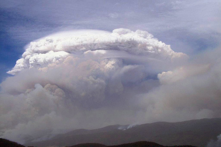
Pyrocumulus Supercell
In Australia on 18 January 2003 a supercell formed from a pyroCb associated with bushfires near Canberra and produced a violent fire tornado, with wind speeds of 250km/h. That storm killed four people and injured 492. That’s the most recent but not the worst. In 1926 lightning struck an oil facility in California sparking a fire. PyroCbs, thunderstorms, fire tornados and whirlwinds raged for four days.
Photo: New South Wales Rural Fire Service
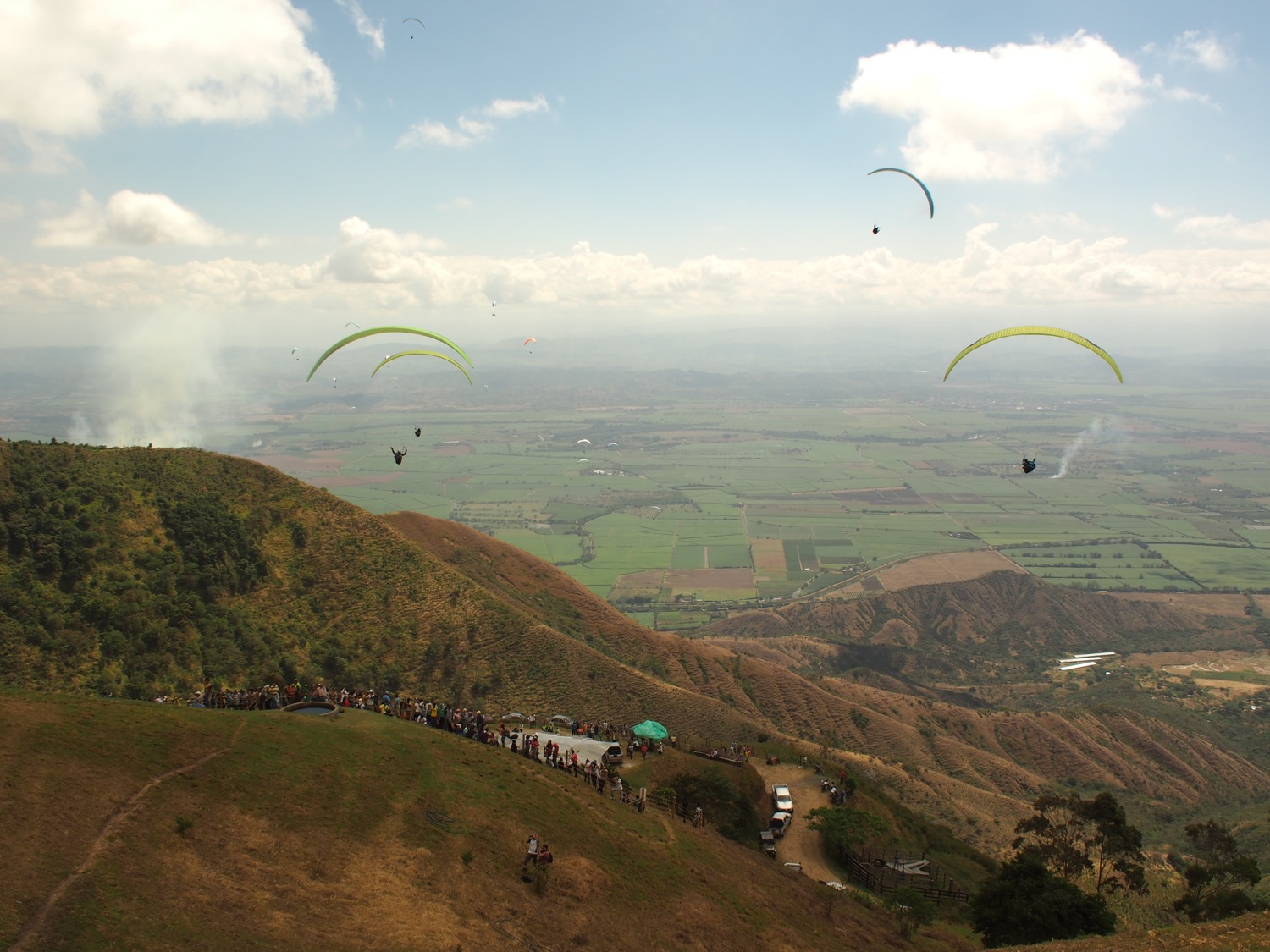
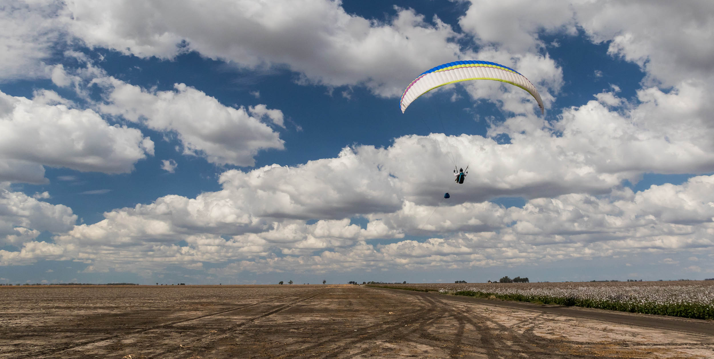
The view from launch at Roldanillo on 12 January 2015. The smoke on the left is from a burning stubble fire. Photo: Ed Ewing
The fire thermals and pyrocumulus we have seen here are nothing like the photos above, and are much smaller in scale. But they can still pack a punch – and perhaps give an unfair advantage to pilots willing to fly in them – hence the organisation’s unwillingness to allow pilots to flirt with fire.
• Got news? Send it to us at news@xccontent.local